

Spatiotemporal segmentation of satellite image time series using self-organizing map
by B. L. C. Silva¹, F. C. Souza¹, K. R. Ferreira¹, G. R. Queiroz¹, and L. A. Santos¹
1National Institute for Space Research (INPE), Brazil
DOI: https://doi.org/10.5194/isprs-annals-V-3-2022-255-2022
Publisher: ISPRS | Published: 17 May 2022
© Author(s) 2022. This work is distributed under the Creative Commons Attribution 4.0 License.
Abstract
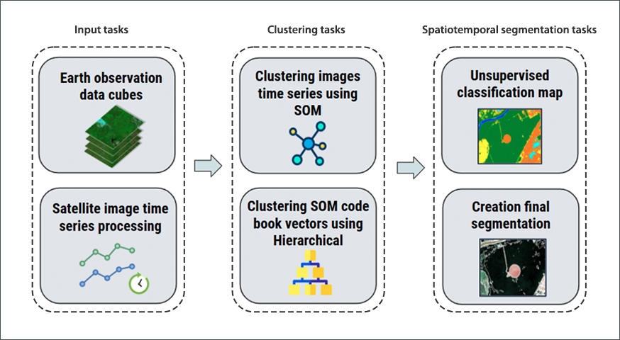
Nowadays, researchers have free access to an unprecedentedly large amount of remote sensing images collected by satellites and sensors with different spatial, temporal, and spectral resolutions. This scenario has promoted the use of satellite image time series for spatiotemporal analysis. This paper presents a methodology for spatiotemporal segmentation of satellite image time series. Spatiotemporal segmentation finds homogeneous regions in space and time from remote sensing images based on spectral features. The proposed approach is unsupervised based on the self-organizing map (SOM) neural network and hierarchical clustering algorithm. It was implemented and applied to a region in the Mato Grosso state, Brazil. The results were evaluated using qualitative and quantitative approaches. In the qualitative approach, visual analysis was performed based on the land use and land cover map of the TerrraClass Cerrado project. In the quantitative approach, supervised and geometric metrics were used to analyze the quality of the produced segments. The results obtained are promising since the segments produced were homogeneous and with a low occurrence of over-segmentation.
Keywords: Spatiotemporal Segmentation, Satellite Image Time Series, Land Use and Land Cover Changes, Unsupervised Classification, Clustering Algorithms, Earth Data Cubes