
Sentinel-2 – Cerrado Biome – Mosaic
by BDC Team
National Institute for Space Research (INPE), Avenida dos Astronautas, 1758, Jardim da Granja, Sao Jose dos Campos, SP 12227-010, Brasil
DOI – https://doi.org/10.52169/BDWU9608
Posted by Inpe | Published: February 2022
Overview
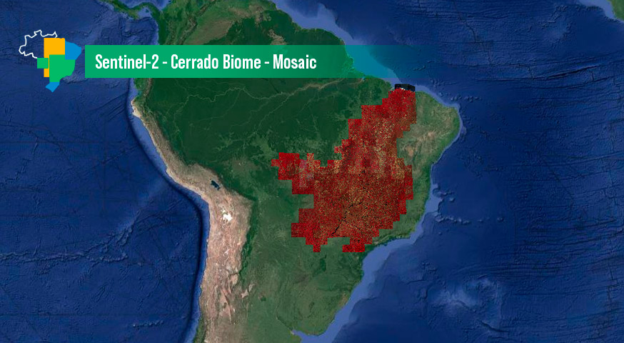
An image mosaic of the Sentinel-2 images covering the Cerrado Biome in Brazil. It was created from a Sentinel-2 data cube, with 10 meters of spatial resolution images, 4 months of temporal step, using the Least Cloud Cover First (LCF). RGB composition of the NIR (B08), Green (B03) and Red (B04) bands.
The technologies developed in the Brazil Data Cube project assisted in the generation of the mosaic, mainly in the steps of scene selection and composition of tiles free of clouds and cloud shadows. Product generation uses the LCF (Least Cloud First) composition function to select the best pixel within the period starting in June and ending in September 2022. The steps of joining the tiles and cutting were done manually and Finally, Geotiff was converted from 16 to 8 bits to save space. The final product is an RGB colored composite of the respective NIR(B8), Red(B4) and Green(B3) bands.
Data Access
Mosaico Sentinel 2 – Cerrado can be accessed through the Brazil Data Cube portal and also through GIS applications through the OGC WMS service, using the following address:
https://brazildatacube.dpi.inpe.br/bdc/geoserver/mosaics/ows
(MOSAIC-S2-CERRADO-4M-1)
Additional information
| Temporal Coverage | Start Date: 07/01/2020 End Date: 09/30/2020 |
| Coverage | West-bound Longitude: -61.75031417469509 South-bound Latitude: -24.78897657651447 East-bound Longitude: -40.057419619168286 North-bound Latitude: -1.7795418369728329 |
| Processor | Software: Cube Builder – 0.4.0 |
| Instruments | MSI |
| Platform | SENTINEL-2 |
| Sources | Sentinel-2 SR – LaSRC/Fmask 4.2 |
© Esta obra foi licenciada sob uma Licença Creative Commons Atribuição-NãoComercial 3.0 Não Adaptada.