
CBERS-4 – 20m – 2 months
by BDC Team
National Institute for Space Research (INPE), São José dos Campos 12227-010, Brazil
DOI – https://doi.org/
Publisher: Inpe | Published:
Overview
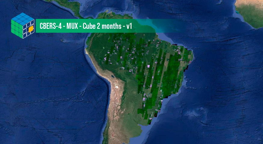
This datacube was generated with all available surface reflectance images from MUX sensor on board CBERS-4 satellite. The data is provided with 20 meters of spatial resolution, reprojected and cropped to BDC_MD_V2 grid, composed each 2 months using the best pixel (LCF) composite function.
Data Access
CBERS-4 – MUX – Cube 2 months – v1 can be accessed through the Brazil Data Cube portal and also through the STAC service, using the following address:
https://brazildatacube.dpi.inpe.br/stac/collections/CB4MUX-2M-1
Additional information
| Temporal Coverage | Start Date: 01/01/2016 End Date: 30/04/2023 |
| Coverage | West-bound Longitude: -75.9138366701095 South-bound Latitude: -34.6755645921443 East-bound Longitude: -27.9114219188032 North-bound Latitude: 5.92600444095035 |
| Instruments | MUX |
| Platform | CBERS-4 |
| Sources | CBERS MUX – Cube Identity v2 |
© Esta obra foi licenciada sob uma Licença Creative Commons Atribuição-NãoComercial 3.0 Não Adaptada.