Slide 1

Production, visualization and analysis of large volumes of remote sensing images modeled as multidimensional data cubes for the entire Brazilian territory.

Minicourse SITS – R package for Satellite Image Time Series

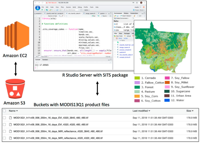
No dia 13 de setembro de 2019 foi realizado o minicurso do SITS, no INPE. O minicurso foi ministrado pelo doutorando da CAP, Rolf Simões, para a equipe do Brazil Data Cube Project e interessados, no Auditório do OBT/SEREII. O pacote SITS (Satellite Image Time Series) inclui recuperação de dados de um WTSS (serviço de …

The Brazil Data Cube project won a grant to improve the understanding of our planet

The “Brazilian Earth Observation Data Cube using AWS for Land Use and Cover Change” project was chosen among several proposals by the Group on Earth Observations (GEO) and the Amazon Web Services (AWS). It was awarded US$ 60,000 through the Earth Observation Cloud Credits Program The winners were announced on Monday (10/06) in Washington, United …

Brazil Data Cube - 2019 - 2024