Slide 1

Production, visualization and analysis of large volumes of remote sensing images modeled as multidimensional data cubes for the entire Brazilian territory.

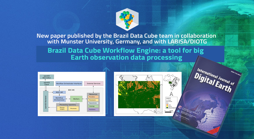
New article published by the Brazil Data Cube team in partnership with the University of Munster, Germany, and LABISA/DIOTG.

The article “Brazil Data Cube Workflow Engine: a tool for big Earth observation data processing” was published this week in the journal “International Journal of Digital Earth” by the Brazil Data Cube project team in partnership with the University of Munster, Germany, and the LabISA/DIOTG Laboratory. The article demonstrates the advances in research and development …

The Brazil Data Cube team presented a course at the XIII Journey of Education in Remote Sensing in Manaus

This week, from November 21st to 25th, 2023, the XIII Remote Sensing Education Journey within Mercosur is taking place at the Normal Superior School, State University of Amazonas, in Manaus, Amazonas, Brazil. On the first day of the event, November 21st, the BDC team conducted the course ‘Earth Observation Data Cubes and Analysis of Temporal …

Brazil Data Cube platform for crop mapping

The new paper “Improving crop mapping in Brazil’s Cerrado from a data cubes-derived Sentinel-2 temporal analysis”, published by the researchers Michel Chaves and Ieda Sanches, highlights the use of the Brazil Data Cube Platform for agricultural area mapping in Brazil. Based on spectral indices extracted from Sentinel-2/MSI satellite data cubes with temporal resolution of five …

BDC participated in the “TerraClass Brazil” Workshop.

The BDC team participated in the discussions and presented the project’s solutions at the “TerraClass Brazil” Workshop – Mapping Land Cover and Land Use in Brazil, held on October 16th and 17th at IBGE in Rio de Janeiro. The objective of the workshop was to gather experts in geotechnologies to devise the best organizational and …

Brazil Data Cube attended the event “Capacity Program Strengthening Geospatial Capacities in the Caribbean”

The BDC team presented the project at “Webinar 3: ODC Use Cases”, at the “Capacity Program event Strengthening Geospatial Capacities in the Caribbean” that took place on June 27, 2023, remotely. The presentation “Accessing and Processing Brazilian Earth Observation Data Cubes with the Open Data Cube Platform” demonstrated the integration between the Brazil Data Cube …

The Brazil Data Cube project is presented in the Land & Carbon Lab’s 2023 Summit event

The BDC team presented the project in the Land & Carbon Lab’s 2023 Summit – Monitoring Land, Mobilizing Action, which took place June 27-29, 2023, in Brussels, Belgium. The data and software products developed in the project for land use and land cover mapping using image time series analysis and artificial intelligence were presented in …

Brazil Data Cube project in the GEO Open Data and Open Knowledge Workshop in Geneva.

The Brazil Data Cube project was presented yesterday in the GEO Open Data and Open Knowledge Workshop. The Open Data and Open Knowledge is a two-day workshop organized by the Data Working Group, together with the GEOSS Platform and the GEO Knowledge Hub teams, that took place in Geneva from 15-16 June 2023. The workshop …

Brazil Data Cube’s team attended the XX Simpósio Brasileiro de Sensoriamento Remoto – XX SBSR-2023

The Brazil Data Cube team actively participated in the XX Brazilian Symposium on Remote Sensing – XX SBSR 2023, in Florianópolis, SC, Brazil, from April 2nd to 5th. During the event, the team was involved in several activities, starting on April 2nd, where the mini-course “Earth Observation Data Cubes and Analysis of Image Time Series” …

Mosaics generated from Sentinel-2 images by the Brazil Data Cube project

The Brazil Data Cube (BDC) project team releases two new mosaics of the Brazilian Amazon and Cerrado biomes. These mosaics were produced using the BDC project technologies, the software DataCubeBuilder and the surface reflectance images of the Sentinel-2 data cubes of 16 days with spatial resolution of 10 meters. To select the best cloud-free and …

TerraClass Cerrado launches mapping produced with technologies and data from the Brazil Data Cube project.

The TerraClass Cerrado project released on December 15, 2022, a mapping of land use and land cover in the biome for the year 2020, produced using technologies and data from the Brazil Data Cube project. This mapping was generated using time series analysis extracted from large volumes of Sentinel-2 satellite imagery data cubes and artificial …

Brazil Data Cube - 2019 - 2024