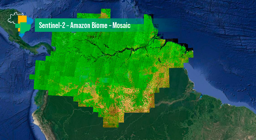
Sentinel-2 – Amazon Biome – Mosaic
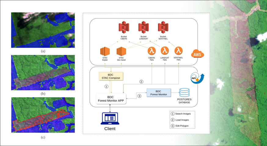
by BDC Team National Institute for Space Research (INPE), São José dos Campos 12227-010, Brazil DOI – https://doi.org/10.52169/LQRZ2567 Publisher: Inpe | Published: May 2023 Overview An image mosaic of the Sentinel-2 images covering the Amazon Biome in Brazil. It was created from a Sentinel-2 data cube, with 10 meters of spatial resolution images, 3 months of temporal …