
Assessing Satellite Image Time Series Clustering Using Growing SOM
by Rodrigo de Sales da Silva Adeu, Karine Reis Ferreira, Pedro R. Andrade, Lorena Santos
National Institute for Space Research (INPE) – São José dos Campos, Brazil
DOI: https://doi.org/10.1007/978-3-030-58814-4_19
Publisher: Springer Link | Published: 03 October 2020
Part of the Lecture Notes in Computer Science book series (LNCS, volume 12253)
Abstract
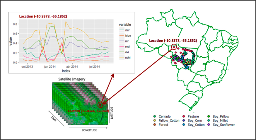
Mapping Earth land use and cover changes is crucial to understand agricultural dynamics. Recently, analysis of time series extracted from Earth observation satellite images has been widely used to produce land use and cover information. In time series analysis, clustering is a common technique performed to discover patterns on data sets. In this work, we evaluate the Growing Self-Organizing Maps algorithm for clustering satellite image time series and compare it with Self-Organizing Maps algorithm. This paper presents a case study using satellite image time series associated to samples of land use and cover classes, highlighting the advantage of providing a neutral factor (called spread factor) as a parameter for GSOM, instead of the SOM grid size.
Keywords: Growing Self-Organized, Map Land use and cover, Machine learning