
BDC Products on AWS Cloud Computing Services Platform
Part of the BDC products are generated on AWS using credits earned in the “Group on Earth Observation (GEO) and Amazon Web Services (AWS) Earth Observation Cloud Credits Programme”. Under this program, the project team earned a $60,000 credit to use over three years with AWS cloud computing services to store and process large volumes of Earth observation data for classification of land use and coverage. The project title is “Brazilian Earth Observation Data Cube using AWS for Land Use and Cover Change”.
In the context of this project, the BDC team developed a service to access and visualize remote sensing images from three different satellites, Landsat-8, Sentinel-2 and CBERS-4, stored as AWS buckets under the Public Dataset Program. This service is currently used by the DETER Intenso project through the Forest Monitor system. DETER Intenso is one of INPE’s projects for detecting deforestation and forest degradation alerts.
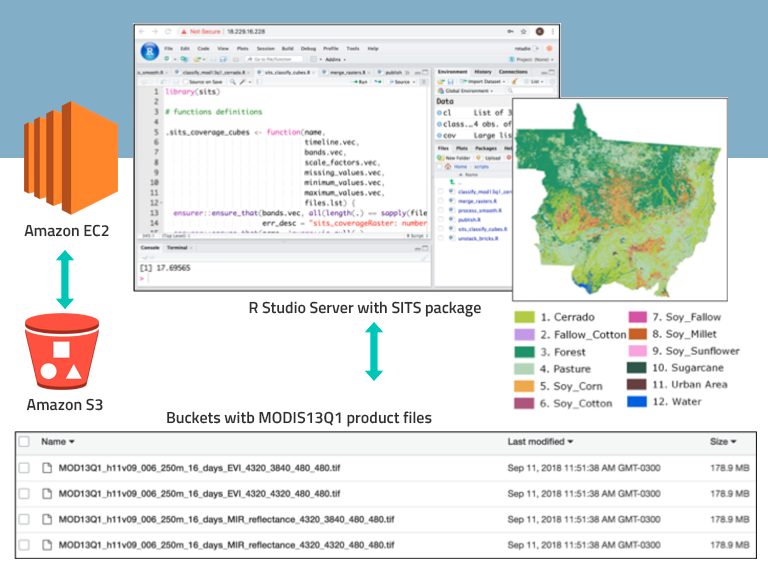
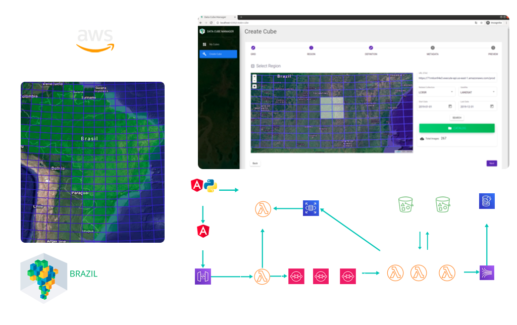
In addition, the BDC team developed a system called Data Cube Builder that runs that runs on AWS using the Lambda service to generate data collections and cubes from remote sensing images stored in AWS buckets. Currently, part of the Sentinel-2 image data cubes from the BDC project are generated on AWS using the Data Cube Builder application. AWS is also used to test land use and land cover classifications from data cubes using time series analysis and machine learning with the sits package.
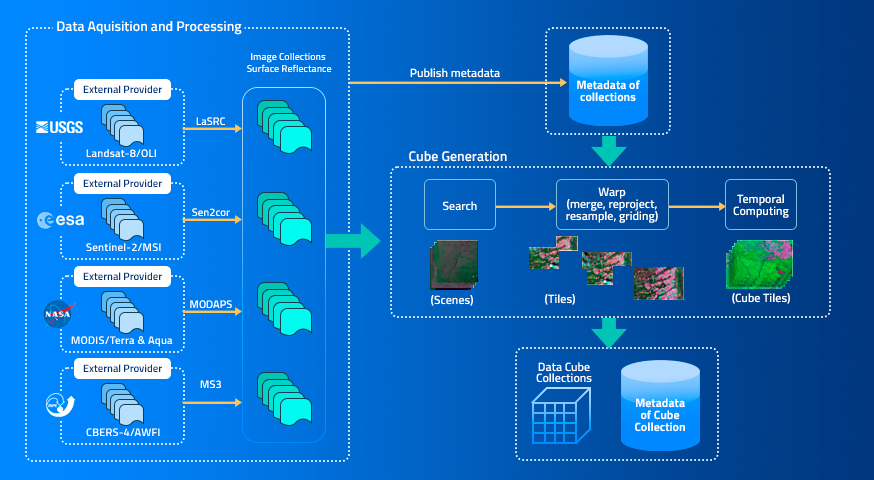
From January 2022, the Earth observation data cubes produced by the Brazil Data Cube project are available on AWS (Amazon Web Service) as Open Data. These data cubes are produced from Analysis-Ready Data (ARD) of CBERS-4, Sentinel-2 and Landsat-8 satellite images for the entire region of Brazil. Based on a hierarchical tiling system, the data cubes are regular in time, created by using a temporal compositing function to select the best pixel (free of cloud and cloud shadow) in each period (e.g. a month or 16 days).
For information about the Brazil Data Cube project data products on AWS as Open Data access:
https://registry.opendata.aws/brazil-data-cubes/.
In addition to providing data sponsorship support (https://aws.amazon.com/earth/), AWS provides Earth on AWS Research Credits for anyone who is interested doing research using Earth Observation or other geospatial data on AWS. More information at: https://aws.amazon.com/earth/research-credits/.

Associated publications:
by K. R. Ferreira; G. R. Queiroz; G. Camara; R. C. M. Souza; L. Vinhas; R. F. B. Marujo; R. E. O. Simoes; C. A. F. Noronha; R. W. Costa; J. S. Arcanjo; V. C. F. Gomes; M. C. Zaglia Earth Observation and Geoinformatics Division, National Institute for Space Research (INPE), Avenida dos Astronautas, 1758, Jardim …